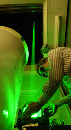
The Spelman Lidar
[Source: Yomiuri Shimbun]
"Lidar" refers to the technology of "Light Detection and Ranging." All lidar systems send out a pulsed beam of laser light, which hits objects or particulate matter, and is then bounced back toward the system, allowing the lidar to record information about the density, distance to, and movement of an object. Industry versions of this include police speed-measuring devices, new cars' ability to "detect" where an object behind the car is and thus stop the car from running into the object, and GIS system that map the topography of the ground and vegetation. Lidar can be used to study volcanoes, earthquake fault lines, rainforests, clouds, mineral concentrations in the upper atmosphere, phytoplankton in the ocean, and so on. It is an essential technology for understanding geographic, oceanic, and atmospheric processes, and therefore has applications to atmospheric and environmental science, environmental justice, and urban planning.
The lidar at Spelman College will mainly be used for studying the lower regions of the atmosphere, specifically the troposphere and the planetary boundary layer (PBL). The PBL is the bottommost part of the atmosphere and is part of the troposphere, stretching from the ground beneath your feet to about 1500 meters. The PBL is a well-mixed, quickly-circulated region where aerosols like dust, pollen, or car exhaust, get lifted up into the atmosphere by the warmth of the sun and can flow from the surface to 1500 meters up in a matter of a couple of minutes. This makes it the ideal region to study aerosols affecting human health that are environmental and social concerns.
The lidar at Spelman can be used to study: air quality, cloud patterns, PBL height and stratification, and meteorology. However, since the apparatus is being made, altered, and improved at Spelman, there are several possible research jobs for students interested in or majoring in engineering, mathematics, computer science, physics, and environmental science. There are three possible teams that you could be involved in, if you're interested:
- Lidar Construction Team: helps design and implement new additions to the system by constructing a mount to hold the lidar mirror, install and test new system parts (amplifiers, photomultiplier tubes, depolarization abilities, etc), and conceive of ways to miniaturize and transport the system without harming or jostling any of the components.
- Lidar Software Team: designs, codes, and implements a Labview program that inputs received data through one channel and outputs the data into a saved file, as well as creates a Matlab program that reads in 2D information about the signal and height and outputs a 3D color plot of time vs. altitude with the color representing the density/signal from the object at a certain time and height.
- Data Analysis Team: takes and analyzes data, often following self-designed research projects aimed at studying: the air quality at Spelman vs. Agnes Scott (urban vs. suburban), types of clouds involved in warm or cold fronts, the effect of air quality on city-dweller's health, the correlation between sun photometer data about the aerosol optical depth and lidar data, the difference in the PBL at different times of the year (with varying aerosol amounts, PBL height differences, etc).
SPELMAN LIDAR PROJECT
The Spelman LIDAR project is a federally funded project through the National Aeronautics and Space Administration's CIPAIR Award. The project involves the design and construction of a new portable LIDAR system on Spelman's campus, as well as the implementation of the LIDAR into classes at Spelman to encourage undergraduate research in remote sensing and the atmosphere. The system will be a part of a network of undergraduate research institutions that make remote atmospheric measurements and probe the atmospheric boundary layer.